Color coded a couple of the route with passes you need to go though to from Colorado Springs back to Durango, note for Lizard Head you still need to go over Monarch Pass just the road is little nicer in Winter storm then Hwy 550. I threw in a few of the one way road you can hit in the summer to much higher altitude badges of honor. Pike Peak is variable in the winter depending on snow coming into Colorado. Some could go ski A-Basin and take the prize which puts you over Loveland Pass 11,922 feet, most us drive though Eisenhower tunnel instead taking the pass.
One these are all the paved roads, I have list few more for Gravel and Shelf roads ; )
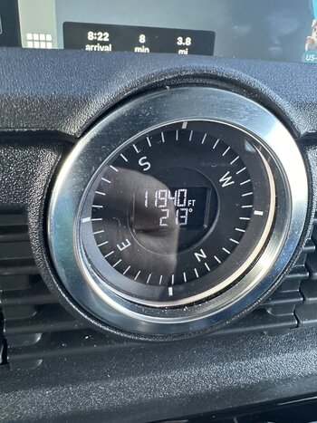
So you have idea of where these passes are relative to Durango and Colorado Springs. Hwy 550 from Ouray to Silverton is alway fun in the Winter. Came back over it to weeks ago on Bluebird day - this was view for Molas pass - you can see the Grenadier Mountains.
View attachment 7847292
View attachment 7847291
View attachment 7847265

")