The Grenadier Forum

Register a free account today to become a member! Once signed in, you'll be able to contribute to the community by adding your own topics, posts, and connect with other members through your own private inbox! INEOS Agents, Dealers or Commercial vendors please use the contact us link at the bottom of the page.

March Madness 2026: Toiyabes Revisited

pmatusov

Grenadier Owner
Lifetime Supporter
Local time
2:42 PM
Joined
Dec 19, 2023
Messages
633
Location
San Diego, CA, USA
This year's March Madness trip's destination was a subject of hundred+ strong email chain.
Death Valley? Nah...
Arizona Strip? Mmmm...
Mojave Road? Nah...
So - Toiyabes it is again. We've only been there in November - but didn't cover much ground.
Chris Snell is at the trip planning again: his "extreme package" translates into about 270 miles on dirt, in one long weekend.
We decide to give it a go, as much as we can manage.

But driving from SoCal to Alamo, Nevada, is an unpleasant proposition on a Friday morning. So three of us elect to camp on Mojave Road.

Have to tell you, driving to a geodetic coordinate in the desert at night is fun. But we've made it.

The morning on Mojave Road:
1776290023690.jpeg

1776290064805.jpeg

1776290107282.jpeg

1776290132095.jpeg


We are ready to go early enough that it doesn't make sense to hit pavement - so we take our time to cut a 23-mile corner of Mojave Desert.
I spot a desert tortoise barely out of our campsite:
1776290440084.jpeg

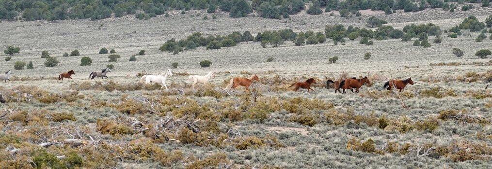
We're enjoying cool morning air and very little dust - going across lava flows, dense Joshua Tree forest, and by old ranches.
1776290469438.jpeg

1776290536932.jpeg

1776290557875.jpeg

We start hearing the conversations of our friends in Las Vegas way before we actually see them; John Lee in his NAS 110 and George in a big black Lexus form a tight convoy around Paul VKD's Series IIA and move at a regal pace of around 50 mph on I-15. We pass them temporarily to hit a gas station on U.S.93, and catch up with them relatively quickly.
Paul is issued a warning by Nevada highway patrol for driving too slowly...

Most of us congregate by the gas station in Alamo:
1776290888343.jpeg

Chris and Ben have a longer haul to Alamo in their 300TDi ROW 110s, so by the time we all meet, we've exhausted things to buy at the store.
Here's the ROW fraction of the group:
1776290973966.jpeg

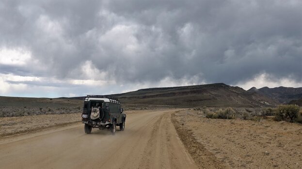
We hit the dirt a few miles north of Alamo, and work our way up the mountain range.
I volunteer for the tailgunner duty - which allows me to see the rest of the group in rare moments when the dust settles.
1776291117727.jpeg

We have a huge group by non-event standards - 12 trucks. By the time Chris finds a campsite large enough for the group, we've covered 40 miles on dirt.
1776291206009.jpeg

I can't skip taking yet another photo of Paul's Series:
1776291244420.jpeg

Here's Ben's ROW 110:
1776291273377.jpeg

The evening views are gorgeous.
1776291325521.jpeg

1776291349690.jpeg

Camping gear is produced, food is sizzling, and drinks are poured. Our trek from Mojave Desert to Great Basin was great.
(to be continued)
 
The plans for the next day were ambitious - we wanted to camp near the ghost town of Belmont, which would be more than 150 miles on dirt.
Chris gave a morale-booster speech the evening before - the plan was to spread out far more, to be able to maintain higher average pace (really, Aaron's rear-facing yellow worklight on the roof of his Grenadier was just about the only thing I saw for about half of the time off pavement yesterday).
... And off we go, past the edge of Worthington Mountain Wilderness, over Heckler Dry Lake, and into Quinn Canyon.
1776293527578.jpeg

In the canyon, we stop by what looked like a whole stone village, with a lot of stone walls, some barbed wire, many outlines of either buildings or corrals
- still not sure what it was.
1776293623581.jpeg

1776293675548.jpeg

This is us crossing Railroad Valley, with Palisade Mesa / Big Fault Ridge looming ahead:
1776293781053.jpeg

Unlike previous times in Toiyabes, these two pronghorns were the only ones we saw on the trip:
1776293839466.jpeg

By this time, most of the trucks were close to Magic Mushroom color - one can barely tell a true MM Grenadier from an Alpine White NAS 110.
1776293937618.jpeg

After a bit of a climb we made it to Lunar Crater:
1776294002216.jpeg

Even if it looks like a meteorite crater, it is actually a maar (kind of a mud volcano). If you, by any chance, are travelling between Tonopah and Ely on U.S.6, it is only 9 miles from that highway.
1776294245253.jpeg

1776294269128.jpeg

On our way towards the U.S.6, the scenery is gorgeous:
1776294301161.jpeg

1776294326667.jpeg

We make it to U.S.6, and drive a few miles West/South toward the turnoff to Hot Creek Ranch.
1776294403442.jpeg

The ranch itself appears to have some sort of a guest house; not sure if that's it.
1776294449982.jpeg

(to be continued)
 
The Hot Creek Canyon is gorgeous by itself; the old structures and still-working ranch make it more exciting. Chris gets to open a lot of gates - I get to close them up.
1776294724841.jpeg

1776294760289.jpeg

1776294778641.jpeg

We're passing a ranch, with an old water truck:
1776294820144.jpeg

... and a 1960 Series II Land Rover:
1776294846931.jpeg

Not that I can tell the year of a Series truck by its appearance; I was lucky to chat with its owner, with a ruddy face of a person spending most of his time outside, dressed in strapped pants and a red-and-black checkered shirt, - who bought the Land Rover new in 1960, and the little 88 has spent all of its life on the ranch.
The road is gorgeous.
1776295031544.jpeg

1776295063762.jpeg

1776295083364.jpeg

1776295118193.jpeg


We arrive to a fork in the road - our intended path is forward up to Eagle Pass. But it's afternoon already, so we turn north on a Little Fish Lake Valley Road - for a lunch stop.
A bit later, we hear the rumble of a big rig towing a large generator up the road - the front tires of the trailer are in shreds, the driver couldn't be bothered to get out and take a look. He's grateful for a beer, though, and goes off towards a water well somewhere.
After a quick lunch, we proceed to Eagle Pass road. Here's a quote from my 9-year-old travel log on the same trail, going in the opposite direction:
"For a while it has nothing to impress us with, and then all of a sudden corkscrews downhill in a series of tight, off-camber, rock-lined, turns.
Soon, Dan is out dismantling his ham radio antenna, and we are wondering what would these really stiff, low, and frequent, cedar branches do to one's rooftop tent. Or how would an F550-based glamping truck fit between the walls. . One of these trees sees a saw to come out and lop off an offending branch."
This time, Chris sees the road washed out and degraded in a major way - it would be impractical and imprudent to keep a 12-vehicle group going up, especially considering nearly-guaranteed snow on a 7-thousand-foot pass.
We retreat back and onto Little Fish Lake Road - this detour will add about 60 miles to today's travails.

Here's Ben's ROW 110:
1776296032405.jpeg


Aaron's Grenadier with my "guiding star":
1776296032422.jpeg


John's NAS 110:
1776296069776.jpeg


That Little Fish Lake:
1776296102918.jpeg

Some 15-20 miles later, a huge herd of wild horses crosses our path. I only get a shot of part of it while they were running parallel to the road:
1776296196079.jpeg

The horses are gorgeous, very fit, and not at all friendly to humans. Last November, a black stallion ran alongside of my Grenadier at nearly 50 mph for several minutes in an attempt to cut me off from the rest of his family.
1776296319939.jpeg

(to be continued)
 

Attachments

  • 1776296295261.jpeg
    1776296295261.jpeg
    713.2 KB · Views: 0
  • 1776295823683.jpeg
    1776295823683.jpeg
    635.6 KB · Views: 0
We still have the Monitor Range to cross - so we turn west and pass the area called "Miniature Grand Canyon" - it looks more like "Miniature Black Canyon of the Gunnison":
1776297066090.jpeg

The road crests at 8500 ft at Dobbin Summit, and then quickly drops 1700 feet to the valley floor.
1776297166692.jpeg

We're on an "improved road," so we can lean on the stupid pedal and make a quick work of 40 miles to Belmont.
1776297320514.jpeg

At least, the wind blows the dust off to the side:
1776297344809.jpeg

The scenery - purely Altiplano in Peru or Chile, or Patagonia:
1776297413122.jpeg

Sometimes it feels odd not to see alpacas in the brush.
1776297455518.jpeg

The storm looms close - that's the first time I've seen mammatus clouds:
1776297492510.jpeg

But the clouds and rain stay on the other side of Monitor range; it is late afternoon but warm, sunny, and beautiful when we roll into Belmont:
1776297781954.jpeg
... and find Dirty Dick's Saloon open - for the first time in years!
1776297607273.jpeg

1776297581731.jpeg

In all fairness, we've been warned more than once:
1776297649876.jpeg

For something that's only open "Occasionally," the bar is well-stocked, and cocktails are $5 a pop:
1776297704582.jpeg

The place is thoroughly decorated:
1776297754893.jpeg

1776297823553.jpeg

The bar is cash-only, which makes me bum one drink from Aaron and another - from Andrew. Shame on me.
The owner stops by, and we have a long conversation regarding differences between urban California and rural Nevada. We promise not to pollute the land with urban-californian policies and demands, and reluctantly leave.
Once we tell the owner that we aren't going to the campground, he knows exactly where we are staying.
1776298021349.jpeg

There's plenty of room for everybody - enough even to roll around for a while to find the bestest-best spots.
1776298189977.jpeg

Kristian and I camp here, Chris and Ben - a little farther behind.
1776298108844.jpeg

Nevada's close second to Arizona in sunset quality.
1776298156362.jpeg

1776298321307.jpeg

Kristian's truck:
1776298247618.jpeg

No megabytes have been harmed in mandatory filming of the campfire, sorry.
(to be continued).
 
We've covered about 180 miles on Saturday - all but 1 on dirt.

Sunday morning came up bright and clear, and on a cold side - Kristian's weather tool reported crisp 29F air.
Most of us were now concerned about getting home - John had the shortest "commute" around 260 miles, it was between 450 and 550 miles for us in Southern California and Draper, Utah, and over 650 - for Kristian in Bay Area.
The first stretch was common for all - south through Belmont, so we could get another glimpse of its majestic courthouse.
1776358994769.jpeg

1776359032875.jpeg

South of town the group split - with the most people high-tailing south to U.S.6, and five of us - west through Manhattan, Nevada.
Manhattan is a mining town with allure that we still have to discover.
1776359182435.jpeg

1776359201757.jpeg

1776359346332.jpeg

At the junction with Nevada 376, we parted ways - Chris and Ben started their 500+ mile trek to Utah, Aaron, Kristian and I - our 500+ mile trek south to various places in California.
Kristian wasn't having fun on pavement, so he offered us a "backdoor" route to Tonopah.
1776359536769.jpeg

We continued on U.S.95/6 and onto U.S.6 towards Bishop. It is a beautiful route, with little traffic on weekdays and almost none on a Sunday.
You can't beat the views like that:
1776359615244.jpeg

1776359643509.jpeg

1776359663602.jpeg

Once we're out of Chalfant Valley and on the blacktop of U.S.395, Kristian inquires if we'd rather make a side trip to a mine famous for its long tunnel. Who are we to turn it down?
Of course, Kristian picked the longest possible way to get there - complete with washboard, moon dust, a few little salty mud bogs, and rocks here and there. Soon, we cross the tracks of the former Carson & Colorado Railroad, which was connecting Keeler (at the Death Valley's doorstep) in California and Mound House in Nevada. The railroad was built in 1883, and was in operation until April of 1960.
1776359981826.jpeg

Soon after the crossing, the road turns very rocky and steep - enough to thin out the Subaru crowd.
Navigating the rocks was enough of business to forget about photography, till we stop at the mine entrance and can take a completely vanity shot:
1776360155031.jpeg

The views of the Owens River Valley some 500 ft below and towering 14k-ft peaks of High Sierra were outstanding.
A couple hundred feet left of our trucks lies the entrance to Reward Mine tunnel. The mine site was discovered in 1870, and this mine produced a lot of copper-gold ore between 1911 and 1952, with enormous amount of lead as a byproduct. Now the mine is famous due to its tunnel that is wide and tall enough to allow a vehicle nearly all the way to the end (~1/2 of a mile); most side-by-sides fit, a factory Wrangler on stock tires might fit, and a Grenadier won't. It should be a fun trek on a vehicle, though - there are many places to allow two vehicles to pass each other or to make a three-point turn.
1776360671060.jpeg

Without any flashlights, after the first two turns the tunnel gets completely, profoundly, dark.
1776360713001.jpeg

We enjoyed the walk, and came back out to have lunch and part our ways yet again.
1776360757474.jpeg

1776360778373.jpeg

1776360797995.jpeg

We say our goodbyes in Lone Pine, and I make a very good time on my way home nearly bypassing Sunday evening traffic from Las Vegas to SoCal.

The trip added about 1300 miles to my Grenadier's odometer (which crossed 49kmi mark near Reward Mine), out of which nearly 400 were on dirt.
 
Back
Top Bottom